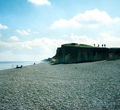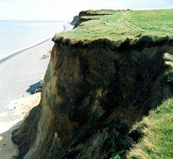
At Weybourne Hope we say goodbye to the mudflats and saltmarshes that have accompanied us all the way from Holme – or even from Snettisham if you decided to add a few extra miles on at the start. The cliffs rise up out of the ground here and, for the first time in this walk of contrasts, our path becomes a clifftop one. And an object lesson of the terrible effects of coastal erosion as the walker passes houses that are increasingly on the point of tumbling into the sea. Despite these sad reminders of the unpredictability of the coast this is a lovely bit of walking. And one to be savoured, because as the path homes in on Cromer it increasingly meanders inland to avoid caravan parks, sewage outfalls and the entire village of West Runton. That this should happen with Cromer practically within spitting distance is, frankly, something of an anticlimax – although some of the walking is very enjoyable and the woods and farmland add another dimension to the path. But, the fact is, this is a national trail and billed as a ‘coast path’ – so having to do the last couple of miles inland on woodland trails and roads is a bit disappointing. It’s not clear whether coastal access will ever be improved, as sometimes happens on sections of the South West Coast Path – but it needs it, as things stand.
Cliff-top pleasures

But enough grumbling. For the time being we shall enjoy our high-level stroll along the clifftops, enjoying the sounds and smells of the sea, watching the breakers roll in and pausing to look back down the coast and congratulating ourselves on how far we’ve come (and the fact that Wells lifeboat house is probably finally out of sight). On the approach to Sheringham the path skirts the edge of a golf course and the walker experiences a few unfamiliar ups and downs – has no-one pointed out that this is Norfolk? Sheringham is one of the larger holiday towns along the path and is a proper old-fashioned seaside resort, proud of its beaches and attractions. As such, and in common with places like Wells and Blakeney, it can eat up more time than you expect and this is one reason to make this last stage a little shorter, leaving yourself time to browse through Sheringham and also to celebrate your arrival in Cromer.
The high ground

On the way out of the town you’ll be hard-pressed to miss another major attraction of the path – the Beeston Bump, which is really quite a lot to throw at tired walkers or those who may have left Sheringham feeling a little bit post-prandial. Close to the village of Beeston Regis, this bloody great hill is jokingly referred to as Norfolk’s highest point – who knows, it might actually be true. Back on the flat again and this is the last you’ll see of the sea until you’re most of the way to Cromer pier. Soon you’re on National Trust land and heading uphill. You get the occasional glimpse of sea through the trees but mainly it’s classic woodland walking on tracks through plantations. You know the end is approaching when you pass under the beautiful brick Midland and Great Northern Joint Railway arch and now increasingly you are on roads and passing through the Cromer suburbs.
The end in sight

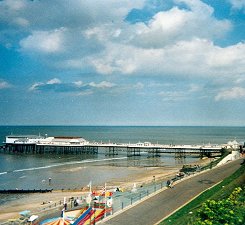
So, how to end your walk? Just stopping at the railway station seems a terrible anticlimax. Personally, we have always found the end of the pier to be the most satisfying place to celebrate the conclusion of this adventure, even if it is quite a drop down to sea level to get there. Last time we celebrated with chips and that famous old Norfolk delicacy deep-fried doughnuts (six for a pound). Just thinking about them makes the mouth water. Perhaps it really is time that we got going and walked back the other way, from Cromer to sunny Hunny….